For UK surveying projects, LiDAR is often better suited to vegetation, complex structures and powerline corridors, while photogrammetry can be a more cost-effective choice when high-resolution imagery and surface mapping are the priority. This blog by AUAV helps you understand the exact difference between the two and what could be the right pick for your project goals.
Drone LiDAR and drone photogrammetry: the former uses laser pulses to create detailed 3D point clouds, while the latter builds measurable maps and models from overlapping aerial photographs. Both methods can support accurate drone surveying and aerial mapping, but they collect data differently.
Selecting the right one for your project in the UK should start with one question: what information does your project actually need? If you select the wrong mH2ethod, it simply means you will pay for data you don’t need or receive outputs that don’t answer the core questions of your project.
Across our projects in the UK, site conditions can vary considerably, from vegetation-covered land and utility corridors to construction sites and complex infrastructure. Our expert survey team assesses which among LiDAR, photogrammetry, and a combined approach is suitable for the required project outputs. Wherever relevant, we can also draw on previous UK survey projects to determine suitable capture methods, flight planning, and deliverables for comparable site conditions.
What Is the Difference Between Drone LiDAR and Photogrammetry?
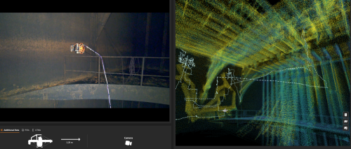
An aerial LiDAR survey sends laser pulses towards surfaces and measures their return to create a three-dimensional point cloud. AUAV identifies dense vegetation, complex or reflective structures, powerline vegetation assessment and conductor catenary analysis among the areas where LiDAR can be particularly useful.
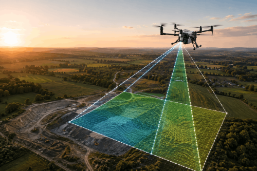
Photogrammetry takes overlapping RGB photographs from different positions. Processing software identifies common points across those images to generate georeferenced orthomosaics, point clouds and elevation or 3D models.
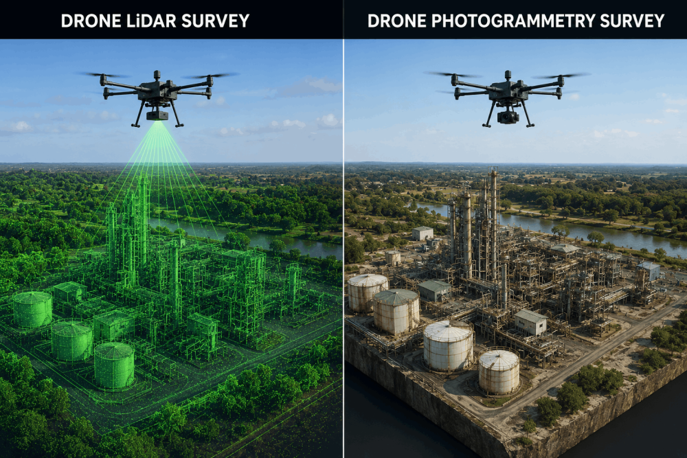
LiDAR and Photogrammetry: Project Requirements Compared
|
Project Requirement |
Drone LiDAR |
Photogrammetry |
|
Dense vegetation |
Strong option for reaching ground through gaps |
The surface can be obscured by vegetation |
|
High-resolution site imagery |
Not its primary advantage |
Strong |
|
Complex geometry |
Well suited |
Project dependent |
|
Powerline corridors |
Useful for vegetation and conductor analysis |
Useful for visual mapping |
|
3D point clouds |
Yes |
Yes |
|
Relative capture cost |
Typically higher |
Typically lower |
In practice, the choice is rarely based on the sensor alone. Our survey team considers site conditions, vegetation, required accuracy, intended deliverables and how the data will ultimately be used before recommending LiDAR, photogrammetry, or a combination of both.
Need help to select the right survey method for your site?
When Should You Choose a Drone LiDAR Survey?
From our experience surveying infrastructure and land-based projects, LiDAR becomes particularly valuable where vegetation or complex geometry limits what can be reliably captured from imagery alone, where the physical characteristics of a site make image-based reconstruction difficult.
The required point density, ground visibility and final engineering outputs should all be considered when planning the survey.
1. Surveying Ground Beneath Vegetation
Laser returns can pass through gaps in the tree and vegetation cover, allowing some pulses to reach the terrain below. This makes drone LiDAR survey UK services particularly relevant to wooded sites, infrastructure corridors and land where ground-level information is required.
2. Mapping Powerline Corridors
LiDAR can support vegetation-encroachment assessment and conductor catenary analysis. This makes it useful alongside distribution pole inspections and wider electricity-network surveys.
3. Capturing Complex Structures
Industrial infrastructure and structures with complicated geometry may benefit from direct laser measurements, particularly where reliable 3D spatial information is the main requirement.
4. Covering Large Areas Efficiently
AUAV also uses LiDAR where large areas need to be captured, and the resulting data is required quickly after acquisition.
When Does Photogrammetry Make More Sense?
For sites with good surface visibility, photogrammetry can provide both detailed spatial data and high-resolution visual context without the additional cost of LiDAR capture. Our survey team typically assesses ground conditions and the required outputs before determining whether image-based mapping will meet the project specification.
LiDAR is not automatically the better survey method. Photogrammetry can be an excellent choice when a project requires detailed visual information alongside spatial data. Typical applications include-
- Topographical surveys
- Construction and infrastructure mapping
- Orthomosaic production
- Stockpile and volumetric surveys
- Coastal monitoring
- Land development
- Progress documentation
- 3D site visualisation
AUAV’s Aerial Survey & Mapping service typically produces survey imagery at 1 to 3 cm ground sampling distance. AUAV reports general 3D-data accuracy around 50 mm horizontally and 50 to 80 mm vertically, although actual requirements and achievable results should always be established for the individual project.
What Outputs Can You Receive?
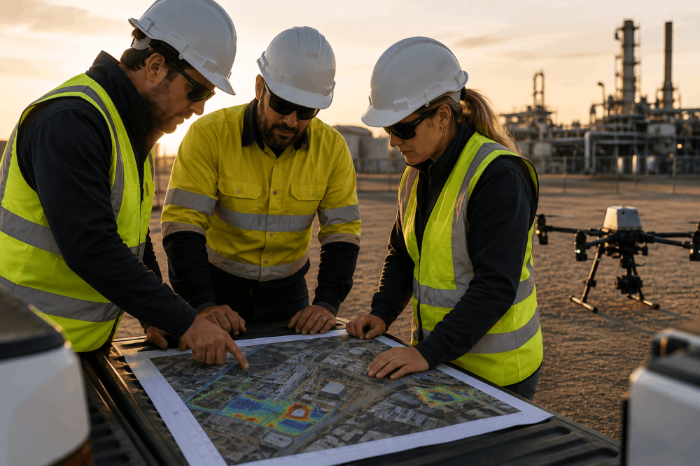
The sensor is only part of the decision. Asset owners, engineers and survey teams should establish the required deliverables before choosing the capture method. We recommend defining the required outputs before the aircraft is deployed. Knowing whether the project team ultimately needs a DTM, orthomosaic, point cloud, CAD-ready data, or another deliverable helps determine the most appropriate capture and processing workflow.
Depending on the scope, drone survey services can support-
- 3D point clouds
- Digital Terrain Models (DTM)
- Digital Surface Models (DSM)
- Orthomosaics
- Contours
- High-resolution imagery
- 3D reality models
- CAD and GIS workflows
AUAV survey results can also be made available through inSite™, its online drone data platform, helping project teams review and work with captured information.
Does Drone LiDAR Cost More Than Photogrammetry?
Generally, yes. AUAV notes that drone-based LiDAR data capture is typically more expensive because of the cost of LiDAR sensors and the aircraft required to carry them. That does not mean photogrammetry is always the cheaper project option.
If vegetation, complex geometry or the required analysis makes photogrammetry unsuitable, selecting it based purely on capture price can create additional work later. The survey method should therefore be assessed against the required outcome, not sensor cost alone.
In our experience, the lowest capture cost does not always result in the lowest overall project cost. Choosing a survey method that cannot reliably produce the required information can lead to additional processing, repeat surveys, or supplementary data collection.
Avoid This Common Survey Planning Mistake
One of the easiest mistakes is requesting ‘a drone survey’ without defining what the project team needs from the data. Before engaging aerial survey services in the UK, establish-
- What needs to be measured or mapped?
- What accuracy is required?
- Is ground information beneath vegetation important?
- Is high-resolution imagery required?
- What format does the engineering or GIS team need?
- How will the data be used after delivery?
A recurring issue we see at the scoping stage is a brief that specifies the technology before clearly defining the required outcome. Starting with the measurements, accuracy and deliverables allows our survey team to recommend the capture method around the project rather than the other way around. These answers usually make the LiDAR-versus-photogrammetry decision much clearer.
Have a site but aren’t sure which data-capture method fits the brief?
Frequently Asked Questions
Is drone LiDAR more accurate than photogrammetry?
Not automatically. Accuracy depends on the sensor, aircraft, flight planning, positioning, processing methodology, site conditions and required output. AUAV notes that LiDAR sensors themselves are available at different prices and performance levels, which can materially affect final data accuracy. The project specification should determine the appropriate technology.
How do I know whether my site needs LiDAR or photogrammetry?
Start with the required outcome rather than the sensor. If you need ground information beneath vegetation or detailed measurements of complex features, LiDAR may be more suitable. If detailed imagery and visible-surface mapping are the priority, photogrammetry may be sufficient.
Can a drone LiDAR see through trees?
LiDAR does not simply ‘see through’ solid vegetation. Some laser pulses can travel through gaps in leaves and branches and reach the ground below. Those returns can help generate terrain information in areas where aerial photographs primarily capture the vegetation canopy, making LiDAR valuable for suitably vegetated sites.
Which is better for a topographic survey, LiDAR or photogrammetry?
It depends on the site. Photogrammetry can produce detailed orthomosaics, surface models and topographic information where ground surfaces are clearly visible. Aerial LiDAR can be preferable where vegetation obscures the terrain, or the project requires specific 3D measurements that favour laser-based capture.
Can LiDAR and photogrammetry be used together on the same drone survey?
Yes. Some projects can benefit from combining LiDAR’s 3D spatial data with high-resolution imagery from photogrammetry. Whether both are required depends on the site conditions, intended analysis and final deliverables.
How much does a drone LiDAR survey cost compared with photogrammetry in the UK?
LiDAR surveys typically have a higher capture cost because of the specialist sensor and aircraft requirements. However, the final survey cost depends on factors such as site area, accessibility, required accuracy, flight complexity, processing and deliverables, so the most cost-effective method should be determined from the project specification.
What information should I provide when requesting a drone survey quote?
Provide the site location and approximate area, project purpose, required accuracy, preferred deliverables, coordinate requirements, terrain or vegetation conditions and timeframe. If you do not know which sensor is appropriate, explain the required project outcome rather than specifying LiDAR or photogrammetry upfront.
Need LiDAR or Photogrammetry for Your Next Project Survey in the UK?
AUAV provides Aerial LiDAR, Aerial Survey & Mapping and related drone survey services for infrastructure, engineering, and land-based projects anywhere across the UK. Talk to the team about your required measurements, outputs and site conditions before deciding which capture method fits the project.